Is Papakolea the only green beach

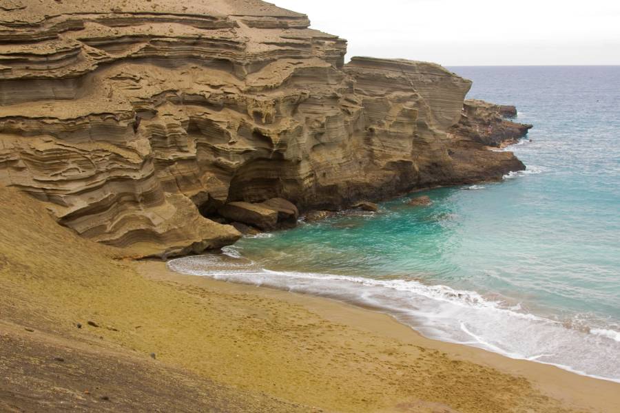
The famous Green Sand Beach in Hawai’i is also called Papakolea or Pu’u Mahana Beach. As much as I know it really has few competitors in terms of purity and freshness of the olivine sand. However, it is definitely not correct to say that it is the only one. The absence of evidence is not the evidence of absence. There is no need to go very far from the Big Island. Diamond Head is a tuff cone in Oahu that constantly feeds the sand beach right next to it with fresh olivine. The sand there is not as bright, but it is definitely composed mostly of olivine and it is green.

Is Papakolea the only green beach
Papakolea beach in Hawaii.

http://picasaweb.google.com/107509377372007544953/Hawaii#5881089836017624546
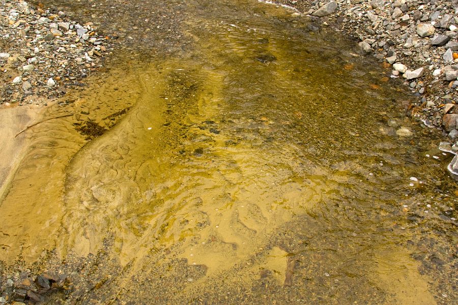
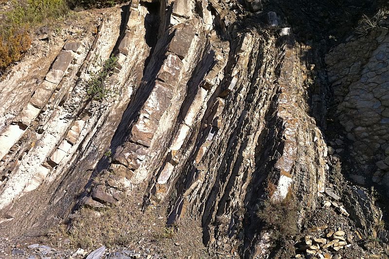
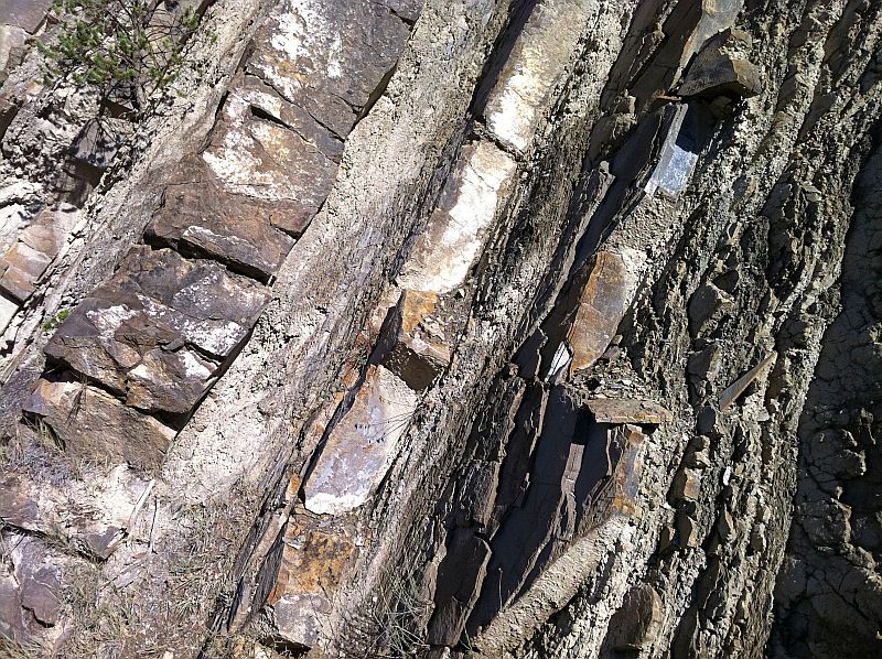
Layered tuff exposure right next to the beach that is the source material of olivine.

Diamond Head sand
Sand sample from Diamond Head Beach in Oahu. White grains are biogenic fragments (corals and forams). The sand is not as bright as are the sample from Papakolea but it is still clearly greenish. Width of view 11 mm.

Papakolea olivine sand
Olivine sand collected near the southern tip of Hawaii. It is from a tiny cove on the coastal trail, not from the beach itself where the grains tend to be duller green. Width of view 10 mm.

It is interesting to take a look at the Pu’u Mahana and Diamond Head volcanoes. There are some striking similarities. They are both located right next to the beach. They both contain lots of olivine. They are both composed of easily erodable pyroclastic sediments. They are both high and steep which speeds up the erosion.

Diamond Head and  Puu Mahana
Pu'u Mahana on the left and Diamond Head on the right. Images taken from Wikimedia Commons: jonny-mt (Pu'u Mahana) and Brian Snelson (Diamond Head).

Why is this needed for the green sand beach to form? Because olivine is unstable mineral at the atmospheric conditions. The transport route needs to be short and erosion fast to ensure that most of the olivine makes it to the beach and there is a constant supply of fresh material.

All right, we have Diamond Head Beach in addition to Pu’u Mahana but it is still only two and both of them are Hawaiian beaches. It may come as a surprise to many but olivine is not rare in sand. I would even say that it is an essential component of sand in many oceanic islands or volcanically active regions. Canary Islands, Iceland, Galápagos Islands, and Cape Verde are just a few names where olivine is a common constituent of many beach sands.

Olivine sand from Sivuqaq
Sand sample containing lots of olivine from Ivgaq, St. Lawrence Island, Alaska. Width of view 15 mm.

I especially love a sand sample from the St. Lawrence Island in the Bering Sea. The climate there is not quite comparable to the Caribbean. That is perhaps the most important reason why this island is not very popular among tourists. The local Yupik people are quite protective about their island as well but I am lucky to know two of them. They sent me a very nice sample from the northern coast of Sivuqaq (St. Lawrence Island in Central Siberian Yupik). This sand sample is not as green as are the samples from Hawai’i because it contains lots of lithic material but olivine definitely dominates among the single minerals and gives greenish hue to the sand.

This greenish sand is composed of almost pure olivine and is a result of weathering of dunitic rocks. Gusdal quarry, Norway.

Sandstone maze in Luxembourg

There is an interesting sandstone maze near Berdorf in Luxembourg, just few kilometers from German border.

http://picasaweb.google.com/107509377372007544953/Rocks#5791313262670985602
http://picasaweb.google.com/107509377372007544953/Rocks#5791313277421944962
http://picasaweb.google.com/107509377372007544953/Rocks#5791313315779378002
http://picasaweb.google.com/107509377372007544953/Rocks#5791313344825869154
http://picasaweb.google.com/107509377372007544953/Rocks#5791313377524076514
http://picasaweb.google.com/107509377372007544953/Rocks#5791313181760546002

This Jurassic (probably) sandstone formation is cut by numerous clefts that form an interconnected network of passageways. It is easy to get lost in this labyrinth of moss covered sandstone walls.

The sandstone is fine- to medium-grained, weakly cemented, and yellow in color.

I recommend to visit this place if you happen to go to Luxembourg and have some free time. The capital of this small country is very scenic as well but these rocks were definitely the most interesting thing I saw there.

Berdorf sandstone disintegrated
The sandstone disintegrated into fine sand. The width of the view is 10 mm.

Volcanic mystery in Santorini

While hiking in Santorini I stumbled upon an interesting rock. What first striked me was the size. It is slightly more than one meter in diameter and weighs several tons. This area is covered with pyroclastic rocks but most of it is ash mixed with fist-sized or smaller clasts of pumice and scoria.

This apparently andesitic block doesn’t seem to be aerodynamically shaped, so it probably isn’t a volcanic bomb. If it was ejected from the crater at all, it was likely already solid or mostly solid. What also puzzles me is the lack of deformation in the tephra beds below the rock. I try to imagine such a giant landing in high speed on a soft bed of ash and pumice and it doesn’t make any sense to me.

Is it possible that the current location of the rock is not where it originally landed? Maybe it rolled downhill to the current location? Or maybe signs of original deformation are somehow lost? I’d like to hear your interpretation.

http://picasaweb.google.com/107509377372007544953/Rocks#5871905464397689442

Update

Gareth Fabbro responded quickly to my question. You can see his answer in the comments thread. So this rock is neither volcanic bomb nor is it a block thrown out of a volcano. It is most likely fragment of an old lava flow that is removed from its original location by a volcanic eruption and associated pyroclastic flows 3600 years ago during the Minoan eruption which most likely also destroyed the mythical Atlantis.

In Memory of Arnold Bouma

This is my addition to Ron Schott’s post on the passing of Arnold Bouma.

Here are my pictures of a turbidity current sequence. Not a complete Bouma sequence and not very good quality pictures but a sequence of turbidity currents it is without doubt.

Bouma described the sequence, later named after him, in 1962. It was almost half a century ago! So he must have lived a really very long life? Actually not so long. He was young when he made his most famous discovery. The same applies to many famous scientists. Einstein and Darwin for example were not even 30 when they already knew things that made them very famous later.

Mudstone and siltstone
Turbidite sequence in the Spanish Pyrenees. Lighter and tougher layers are composed of sand and silt mostly. Darker and softer layers are mostly mudstone that were deposited on top of the sandy layer.

Turbidite sequence
The layers are tilted because of the orogeny that created the Pyrenees and pushed the former marine sediments into near vertical position.

Glacial arch

Glacial arch is a natural bridge made of ice. Here is a picture of a glacial arch formed at the base of the Briksdalsbreen glacier which is a small arm of Jostedalsbreen — the largest glacier in continental Europe.

These archs form because something preferentially melts the ice where the arch will form. It is running water in most cases. Here you can see that there is a debris slope behind the arch. So there is lots of running water in rainy days. And it rains a lot in Norway.

Glacial arch
Glacial arch at the edge of the Briksdalsbreen glacier.

Briksdalsbreen
Briksdalsbreen glacier. An arm of Jostedalsbreen – the largest glacier in continental Europe.

Sandstone columns in the middle of a crater

Columnar basalt is definitely beautiful and interesting rock formation but it is nothing new to a seasoned geologist. Columnar sandstone, however, is probably different story. I had never heard anything about such rocks when I accidentally just stumbled upon one.

There is a large “crater” named Makhtesh Ramon in the Negev Desert in Israel. It is described as the largest makhtesh in the world. That really sounds impressive until you learn that these landforms actually occur nowhere else than in the Negev desert.

So it is simply largest in the Negev but it is impressive anyway. What is makhtesh? It is neither a meteorite crater nor is it a volcanic caldera although it is frequently described as a crater. It is an erosional landform of a structural dome which has softer rocks (sandstone) below and harder (limestone) on top of it. Intermittent rivers called wadis erode the softer rocks faster and create sharp escarpments like crater walls. Makhtesh Ramon has pretty impressive measures. It is 40 km long, 2-10 km wide and 500 meters deep.

Makhtesh Ramon no doubt is worth a visit in its own right but I was most impressed by what I saw in the middle of the makhtesh. There was a hill made of sandstone. But what kind of sandstone! It was like a huge pile of columnar logs. No wonder that this hill is named Ha-Minsara (The Carpentry Shop).

I don’t know exactly how it was formed but I believe the mechanism had to be very similar to the formation of a columnar basalt. Something had to provide lots of heat. There are volcanic rocks nearby in the crater, so it probably was magma. What else could it be? After this baking episode the sandstone slowly cooled and cracks formed when the cooling rock mass contracted. I’d be glad to hear if anyone has a better explanation.

Here are some pictures of the Makhtesh Ramon and the Ha-Minsara in the middle of it.

http://picasaweb.google.com/107509377372007544953/Chert#5807632865374734066
The rim of the Makhtesh Ramon.
http://picasaweb.google.com/107509377372007544953/Chert#5807632703023946434
http://picasaweb.google.com/107509377372007544953/Chert#5807632708113129730
http://picasaweb.google.com/107509377372007544953/Chert#5807632760583574834
http://picasaweb.google.com/107509377372007544953/Chert#5807632772659826002
http://picasaweb.google.com/107509377372007544953/Chert#5807632770462746386
I can’t believe my eyes that this is indeed sandstone.

Syncline in 3D

Have you seen a syncline in 3D? Here is a picture I took couple of months ago in the Spanish Pyrenees. It was an exhausting hike. About 20 km horizontally and 1 km vertically but I really enjoyed it.

An explanation for those of you who do not feel very comfortable in the company of awkward speaking geologists: A syncline is a U-shaped fold. It is a common rock formation in mountainous areas. This particular syncline is interesting because one can see it from different directions. In most cases only two dimensions are visible.

This syncline is largely made of conglomerate I wrote about in this post: Conglomerate – rock of rocks.

Syncline in the Spanish Pyrenees
Castillo D’Acher – a syncline in the Spanish Pyrenees.

Marvellous marble quarry in Karelia

There is a beautiful abandoned quarry in Karelia with bright white walls and deep blue lake at the bottom.

This is Ruskeala marble quarry near the border of Finland. This area was part of Finland before the Second World War but then Russians thought that they don’t have enough land yet. Now we have to go to Russia to enjoy this breathtakingly beautiful place.

The marble quarried in Ruskeala has been used extensively in many famous buildings of Saint Petersburg. Some quarries are abandoned now because of dynamite use which cracked the rock and made it therefore unsuitable for monuments or decorative purposes.

Ruskeala marble
Marble from Ruskeala quarry in Karelia, Russia. White mineral is calcite, dark stripes are composed of graphite. The diameter of the rock is 13 cm.

This marble is really old, it formed in the early Proterozoic. Rocks of that age and even significantly older ones from the Archaean are common in Karelia. This area is geologically the core of Europe around which all other parts like a puzzle pieces one after another later joined.

Mysterious dunes in Estonia

There are weird landforms in the NE corner of Estonia which are called kriiva in Estonia. Most of them look like dunes and they are composed of fine sand but there are some difficulties.

First researchers almost 100 years ago thought that these landforms are marginal moraines because their NE-SW orientation match the orientation of the continental glaciers margin there some 12,000 years ago. However, we see no sign of deformations which should be there if we assume that these landforms are the result of a bulldozing work of an advancing glacier. This hypothesis is largely rejected now.

What is the problem then? First of all, there seems to be at least two morphologically different types of kriivas. First ones are straight and the other ones are curved. I visited several of these landforms about a month ago with some fellow geologists.

We first visited one of the straight kriivas and thought: what a heck, this is like a railway dam running straight through the forest. I never thought that a sand dune might look like this. Both sides of the landform had similar steepness. We made some excavations to look for a cross bedding but found only very subtle hints of it. The layers were mostly parallel and composed of fine well sorted sand. My belief in the dune hypothesis was quickly waning although I couldn’t figure it out what else it might be. All right, let’s assume we had a marginal crack in the glacier where the sediments were accumulating. But the sediments are too well sorted. Glaciers carry all kinds of material from clay particles to large boulders but there were only fine sand.

Then came the curved ones which were different. They are morphologically clearly resembling dunes (one side steeper than the other) and there were some cross bedding in the upper parts of the dune. However, interestingly the lower part of the dune had parallel alternating layers of silt and sand which is a characteristic to ice lake sediments (somewhat similar to varved clay sequences) and definitely not to dunes.

Well, our preliminary conclusion was that maybe these dunes were not dunes at the beginning. Maybe they were indeed some sort of “lake” sediments formed in a narrow crack? When the glacier retreated, some of these straight sandwalls were reworked and became curved dunes and some for some reason remained intact? I really don’t know the answer but if any one of you have experienced something similar, I and one of my friends who is writing his bachelor thesis on these dunes  would appreciate it.

Google Maps is not very competent in this region but here is a link to that area.

LIDAR map of kriiva area
Here is an overview of the area taken from the Estonian LIDAR relief map. S — straight dune, C — curved dune. This map is a courtesy of Estonian land Board.

Straight kriiva cross section
There are many small and mostly abandoned sand quarries which made our job a lot easier. This is the cross section of a straight kriiva. It almost seems to be like a manmade landform.

Curved kriiva cross section
Curved kriiva. These dunes are composed of many smaller dunes that are sitting one on top of the other.

Alternating layers of silt and sand
Alternating layers of silt (darker) and sand (lighter) in the lower part of one of the curved dunes.

Slip side of kriiva
Here we see clearly that the layers (slip side of the dune) are inclined. I measured the maximum true dip which is 28 degrees. The dip of the same dunes windward side was approximately 8 degrees. These are quite characteristic numbers for a dune.

Kriiva sand
Here is an example of the material these dunes are made of. It is fine sand but surprisingly not too well sorted. Note how large are some quartz grains compared to the rest. Dune sands are generally very well sorted so it may be a sign that in this case the transport route of the grains have been very short. It is compositionally typical continental sand. Quartz and K-feldspar are the most important constituents. The width of the view is 5 mm.

Alone on the volcano

Santorini (Thira) is an island in the Mediterranean and possible location of ancient Atlantis. The island is strangely crescent shaped. Its inner edge is high and steep while the outer edge is low.

Santorini resembles a mountain which somehow lost its highest central part. That may sound like a fantasy but that’s exactly what geologist believe happened to the island some 3600 years ago. It was a result of an enormous volcanic eruption which produced more than 60 cubic kilometers of volcanic material. Partially emptied magma chamber collapsed (Wikipedia says that its top was blown off but this is just a popular misunderstanding of a caldera forming process) and the central part of the volcano vanished below the waves.

This volcanic eruption devastated the settlement of Akrotiri in Southern Santorini. This settlement is believed by many to be the location of Atlantis. It is, actually, the most probable location if you ask it from geologists. It makes absolutely no sense to place it in the middle of the Atlantic Ocean as it is often done. It simply can not be there.


Satellite photo of Santorini. Nea Kameni is the dark-colored island in the middle of the caldera. Photo: NASA.

The formation of the caldera 3600 years ago was not the first one there and it will not be the last one either. Santorini is volcanically active (last eruption in 1950) although the current volcanic activity is not concentrated in the main island. There is a small island named Nea Kameni (New Rock) in the middle of the caldera where the volcano is rebuilding itself once again.

I visited Santorini and Nea Kameni in the early spring of 2011. It was off-season. The number of tourists was small but I like it that way. If possible I’d like to visit geologically interesting areas without large crowds. Besides it is far too hot during the summer months. But such somewhat arrogant attitude has its drawbacks also. I really wanted to visit the volcano (Nea Kameni) but there were no boat trips available. We asked (I was there with my wife and 8 months old son) from several places but it seemed to be hopeless. It was really frustrating. That damn island was almost within reach if looked from the caldera rim but still so inaccessible. We still didn’t gave up and one man in the harbour agreed to take us there with his boat. It wasn’t cheap but I think it was worth it. There were only three of us and the volcano.