New beginning

Flowing lava means destruction to settlements in its path and death to vegetation and all other living forms. It leaves behind barren and desolate landscape which for me and undoubtedly to many others is very beautiful and fascinating in its own right. Lava is powerful in the short run and usually unstoppable but eventually living nature wins and conquers it again.

It is amazing how tiny plants start growing on a surface which seems to be a bare rock without any soil cover:

http://picasaweb.google.com/107509377372007544953/Hawaii#5879041477144903954

These small ferns grow on a basaltic pahoehoe lava which is perhaps only ten years old. It is difficult at first for sure but plants are tough and will persevere and it gets easier with every new generation because there already is a small amount of soil to grow on. It may take some time (perhaps only few hundred years in Hawaiian climate or even less) but eventually we would not recognize the landscape because it looks something like this:

http://picasaweb.google.com/107509377372007544953/Hawaii#5879041480561518466

It is funny to me to see ferns as big as these. These plants are common where I live in northern Europe but they are small. It almost seemed that I somehow time-travelled to a Mesozoic forest and would soon meet dinosaurs as well.

Hawaiian style joke

While hiking on a lava field in Hawai’i I suddenly noticed a road sign:

http://picasaweb.google.com/107509377372007544953/Rocks#5878669794529026322

Not that there is a road at the moment but apparently there once was. It may seem funny now but I am sure that it was no joke when this sign was erected. Roads do get cut off there by lava flows and lava does not show any respect to road signs either.

http://picasaweb.google.com/107509377372007544953/Rocks#5878669796744307026

Here is the end of the Chain of Craters Road in southern Hawai’i not far from the sign. This road once connected southeastern part of the island to southwestern but no longer. The road was cut in 1969 but it was reopened ten years later. However, in 1986 it was covered by lava again and since that time there is no road connection anymore and one needs to drive about 100 miles to go and see the other side of the lava field which is about 10 kilometers wide and comes from the Pu’u O’o vent of the Kilauea volcano.

Why is the road still closed? Because we humans are helpless against mother nature. Kilauea and especially Pu’u O’o vent are very active and would certainly destroy the road very soon. I spent several days on this huge lava field and also saw flowing lava. The landscape is full of fantastic lava forms which I hope to soon demonstrate in another post.

Pfeiffer Beach sand

Pfeiffer Beach in California is famous for its purple sand. I’ve seen it included in lists of colorful beaches of the world. I paid a visit to it to see it with my own eyes. It is purple indeed but not entirely. Most of the sand there is composed of quartz, but garnet, which is mostly responsible for the purple color, forms a significant part of it.

In some patches garnet and other heavy minerals are so abundant that the sand has a deep purple color.

Garnet sand
Heavy minerals are sorted out by running water near the coastline.

http://picasaweb.google.com/107509377372007544953/Rocks#5877841632590234418
Purple sand is mostly composed of garnet. Quartz dominates in yellow sand.

A closer look to the sand. It seems to be composed of garnet, epidote, quartz, magnetite, zircon, and many other interesting minerals. Width of view 8 mm.

Lava haze

Intense heat from lava entering seawater initiates a chemical reaction between salt ions dissolved in seawater and water which results in hydrochloric acid (HCl) cloud (lava haze). Geologists love to carry small bottles filled with dilute HCl because it makes a great tool for testing carbonate rocks. Actually, we all carry it along because this is the acid that fills our stomachs. It is diluted, though, but so are acid in geologist’s bottles and also the cloud you see on the picture below.

http://picasaweb.google.com/107509377372007544953/Rocks#5877841693091516370
These “smokes” are mostly composed of water vapor but they also contain a significant amount of hydrochloric acid. They rise from the place where lava flows onto the sea bottom from a lava tunnel. These white acidic plumes are also known as laze (lava + haze). Picture taken in Hawai’i.
http://picasaweb.google.com/107509377372007544953/Rocks#5877841703074302994
Lava itself was not visible but you can see the same flow about 6 kilometers “upstream” in this post: Flowing lava of Pu’u O’o.
http://picasaweb.google.com/107509377372007544953/Rocks#5877841697739732866
This place is surrounded by kilometers of absolutely fantastic and otherworldly landscape.

Be careful when you venture near “smokes” like that because they can be hazardous. It is not recommended to expose your lungs, eyes, etc. to it. People have lost their lives because of acidic laze clouds.

Xenoliths in Hawaiian lava

Lava flow in the western part of Hawai’i that originated from the Hualalai volcano and formed in 1800…1801 is remarkably rich in xenoliths. It is an aa lava. Many nice examples of dunite and peridotite (rocks from the mantle) can be found with a little bit of patience and searching.

Aa lava and dunite xenolith
This is how they look. It often pays to turn the other sides of the clinkery chunks of aa lava because some nice xenoliths are not immediately visible.

Collection of xenoliths
I spent maybe 20 minutes looking for the xenoliths and found a nice collection of rocks containing xenoliths of peridotite and dunite for a picture. I scattered most of the pieces after taking the picture for you to find them again.

Dunite xenolith
Only a very small part of this dunite xenolith was initially visible. After spliting the rock with a hammer, this beautiful example of the mantle embedded in vesicular basaltic lava was revealed. The sample is 8 cm in width.

There is a possibility that these xenoliths are not xenoliths in the strict sense of the word. They might be genetically related to the lava which embeds them. If this is the case, they should be called inclusions instead of xenoliths.

The lava flow is quite wide and long. There is little chance that the location I visited is the best place to find xenoliths there. But here are the coordinates if you are interested to follow my footsteps: 19° 46′ 40″ N 155° 54′ 53″ W. Altitude 620 meters.

Telescopes of Mauna Kea

The summit of Mauna Kea in Hawai’i is one of the best locations on Earth for astronomical observatories. There are many reasons why it is so. The summit is more than 4000 meters above the mean sea level which means that almost half of the mass of the atmosphere is below the telescopes and does not disturb observations. Mauna Kea is also far away from city lights which helps to make the sky above the summit as black as possible and location in the middle of the Pacific guarantees that there is as small as possible amount of industrial pollutants in the air.

The air above the Mauna Kea summit is usually very dry which means lots of cloudless nights. Tropical temperature inversion is well below the summit (it fluctuates between 1200…2400 meters, if present) which protects it from particulate matter from volcanoes and industrial sources and moisture from the ocean. Temperature inversion means that air temperature increases as we go higher. This is unusual situation. As we know, it usually gets colder as we move higher. If there are inversion layer in the atmosphere, it blocks clouds and pollutants from going up because they are cooler and can not penetrate hotter atmosphere above. It is a common phenomenon in many places and when that happens above industrial cities, it means bad air quality for its inhabitants. In Hawai’i, such conditions are very common and associated with prevailing trade winds that blow from northeasterly direction. The inversion is present about 50…70% of the days. Apparently, the inversion was not present on the day I visited the summit because you can see lots of clouds on the pictures below.

Mauna Kea is home to many telescopes operated by scientists from more than 10 countries. Here are some of these telescopes:

http://picasaweb.google.com/107509377372007544953/Hawaii#5875542677695734130
Subaru Telescope (on a cinder cone), Submillimeter Array (small telescopes in the foreground), W. M. Keck Observatory, and NASA Infrared Telescope Facility from left to right. There are no summit crater on Mauna Kea. Its top is covered with conical cinder cones.

http://picasaweb.google.com/107509377372007544953/Hawaii#5875542683681282098
One radiotelescope of the Submillimeter Array.
http://picasaweb.google.com/107509377372007544953/Hawaii#5875542674312206850
Submillimeter Array telescope from another angle.
http://picasaweb.google.com/107509377372007544953/Hawaii#5875542688635676018
W. M. Keck Observatory is the largest telescope in the world. This observatory actually has two domes (picture below), each one hosting a telescope with a 10-meter reflector. This is northeastern dome.
http://picasaweb.google.com/107509377372007544953/Hawaii#5875542703405390738
NASA Infrared Telescope Facility, Canada-France-Hawaii Telescope, Gemini Northern Telescope, and University of Hawaii 2.2 m Telescope.
http://picasaweb.google.com/107509377372007544953/Hawaii#5875542707386797634
Gemini Northern Telescope and Canada-France-Hawaii Telescope.
http://picasaweb.google.com/107509377372007544953/Hawaii#5875542712211504546
Subaru Telescope, W. M. Keck Observatory (both domes visible), and NASA Infrared Telescope Facility.
http://picasaweb.google.com/107509377372007544953/Hawaii#5875542715088458706
Caltech Submillimeter Telescope, James Clark Maxwell Telescope, Submillimeter Array, and Subaru Telescope.
http://picasaweb.google.com/107509377372007544953/Hawaii#5875542724554746322
W. M. Keck Observatory (northeastern dome).

Racetrack Playa and moving rocks

Racetrack Playa is a dry lake in Death Valley. It is home to a geological wonder — moving or sailing rocks. For me, the playa itself without the moving rocks was already quite an experience. The surface of the playa is almost perfectly flat (northern end is few centimeters higher) and firm. There is very easy to walk although it is clear that sometimes after heavy rain the playa must be wet or covered with shallow water body. Racetrack Playa is an endorheic basin which means that there is no outflow. The playa collects water and mud that originates from the surrounding mountains. Water disappears quickly because Death Valley has a hot desert climate, leaving behind dry muddy surface with countless polygonal mudcracks (polygons generally less than 10 cm in diameter).

It is obvious that Racetrack Playa is sometimes covered with water not only because its surface is muddy but also because there are rocks on the playa surface which apparently are moving along the surface, leaving behind clear tracks. This can happen only when the surface is saturated with water. As much as I know, there is no certainty about the mechanism that moves the rocks. It is generally believed that it must be a very strong gust of wind that initiates the movement on the wet and slippery surface (there is much less push needed to keep the rocks moving, initiating the movement is the hardest part). I support the view that rocks are moving primarily because of wind although I have to admit that it is very hard to imagine wind that is so strong. Some rocks are really big and heavy. It has to be one hell of an environment there when these things are happening. It is no wonder that no one has ever witnessed the process.

http://picasaweb.google.com/107509377372007544953/California02#5872323506247910018
The surface of the playa is firm and thoroughly covered with mudcracks. Average mud polygon is about 7 cm in diameter.

http://picasaweb.google.com/107509377372007544953/California02#5872323491421476850
Very flat surface of the playa has larger rocks here and there that are obviously moving sometimes. Most of them have clear tracks behind that show where they came from.
http://picasaweb.google.com/107509377372007544953/California02#5872323502904220050
Some rocks are really huge. Note that this rock has no track. So it was not moving during the last time when smaller rocks did slide and its older tracks have been erased by flooding. But sometimes it too has to move because somehow it managed to travel here. I wonder how? Honestly, how strong wind do we need to move a boulder like that?
http://picasaweb.google.com/107509377372007544953/California02#5872323527102725058
Racetrack Playa has many such sliding rocks. Most of them are concentrated on the SE part of the playa where the source of these rocks is located.
http://picasaweb.google.com/107509377372007544953/California02#5872323536224039042
Most moving rocks are composed of gray dolomite.
http://picasaweb.google.com/107509377372007544953/California02#5872323545757682786
This one is no small rock either. It’s me for scale again.

Racetrack Playa is in Death Valley National Park but it is somewhat harder to access than many other tourist attractions there. It is an isolated and remote valley 27 miles away from Ubehebe Craters where the paved road ends. However, don’t let it scare you. It is quite possible to go there even with a small car. I have read that this rough road is notorious for puncturing tires of small cars but it can really happen anywhere. It happened to me in Death Valley as well but not on a gravel road. It was paved road near Stovepipe Wells. When that happened I thought that I have a nasty and possibly time-consuming problem at hand because the temporary tire is really only a temporary solution in such conditions and it was Sunday. In Europe, people are not moving their lazy ass in Sunday but America seems to be somewhat different, help was actually nearby in the valley. There is a man working at the Chevron of Furnace Creek who quickly repaired the tire for $20. Thanks, you saved me lots of valuable time!

Update

It seems that we finally have a plausible explanation about what actually moves these rocks. It is not wind or more precisely it is not wind alone. It could not be because there are really no gusts that strong to moves these rocks. It seems to be ice that is doing the pushing job. You can read more about it here.

Tallest mountain in the world

Highest mountain, as we all know, is Mount Everest (8848 meters above mean sea level) in the Himalayas. However, there are several different ways to measure the height of a mountain. One alternative way is to measure the farthest point of the Earth’s surface from the center of the Earth. Even Kilimanjaro, the highest mountain of Africa which stands only 5895 meters above mean sea level, is higher than is Mount Everest if measured that way. And the record holder is Chimborazo (6268 meters above sea level) in Ecuador.

These mountains stand so high from the center of the Earth because they are located almost at the equator. Earth is slightly flattened sphere which means that areas at the equator are farther from the center than are polar areas. Hence, equatorial mountains have an unfair advantage over the summits at higher latitudes.

Measuring the height of a mountain from the center of the Earth is understandably very theoretical and perhaps even useless approach. I have never heard that anyone seriously thinks that Chimborazo is the highest mountain on Earth. But the list of possible ways to measure the might and height of a mountain does not end here. Another way to do it is to measure the height from the base of the mountain to its summit. Such an approach could be attractive to geologists because in some cases it gives really much better representation of the real height of a mountain.

It does not make much sense to measure the height of oceanic islands from the mean sea level. Sea level is no permanent marker anyway. It fluctuates in geological time and island volcanoes really do not care about the sea level. They start growing usually from the abyssal plain which is some 5000 meters below the sea level. It doesn’t do much justice to kilometers high and very voluminous oceanic island if we say that it is just a mere 100 meter high rock in the sea.

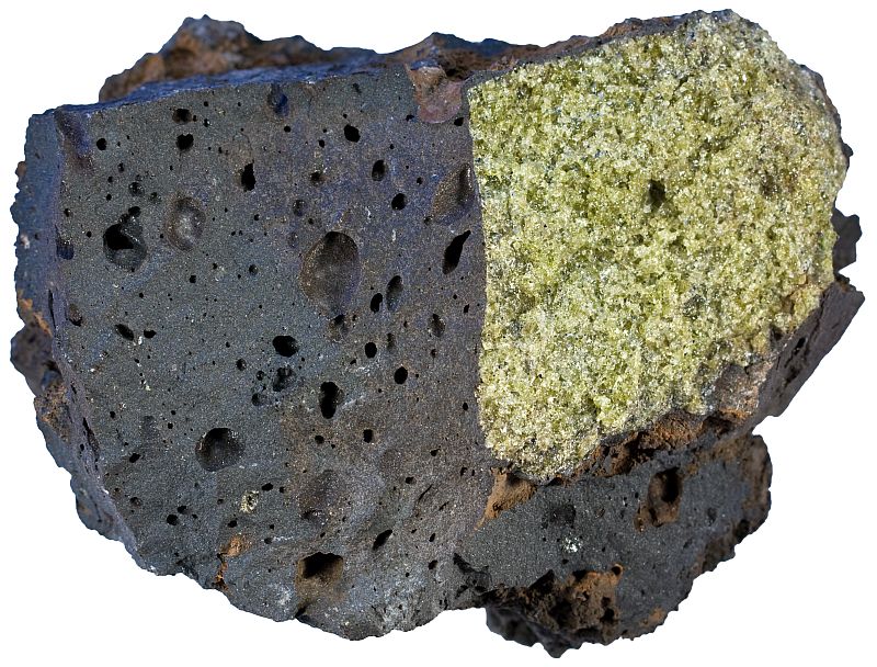
Oceanic islands are indeed the highest or perhaps I should say tallest mountains in the world. Highest and most voluminous oceanic island is Hawaii which is composed of several volcanoes, highest of them are Mauna Kea and Mauna Loa. Mauna Loa is the most voluminous, but Mauna Kea reaches few tens of meters higher. Here is the summit of Mauna Kea which stands 4205 meters above sea level, but its height from its base is more than 10 kilometers!

http://picasaweb.google.com/107509377372007544953/Hawaii#5870808539507438610

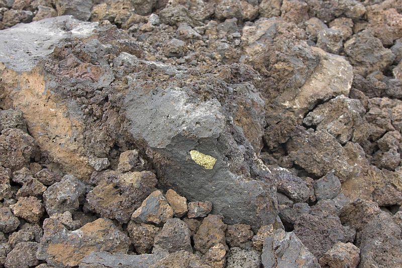
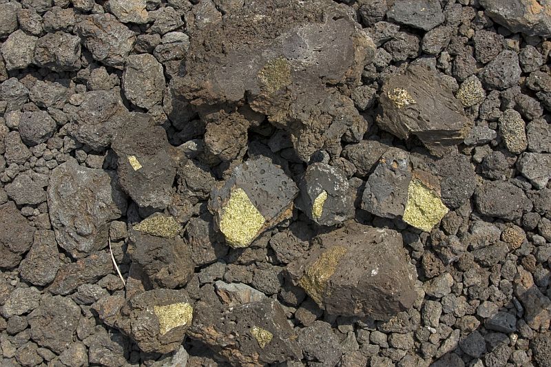
The summit of Mauna Kea is a cinder cone. Its appearance and the angle of slopes may be somewhat misleading because the bulk of the massive island is composed of basaltic lava, not pyroclasts. And its slopes are way more gentle because basalt flows easily and composes mountain with a very large base. I climbed the summit which was quite easy because you actually have to climb less than 100 meters. Mauna Kea has one of the best conditions for land-based astronomical observatories. There are lots of telescopes very close to the summit and obviously there is a road leading to them which means that one can almost drive to the summit.

Ventifacts and dreikanters

Ventifacts are sand-blasted rocks. They are typically faceted and often display parallel grooves carved by wind-blown sand. Ventifacts are common in desert environments where there is enough rocks and sand and little vegetation to keep the sand in place. Strong winds are also needed to lift and carry sand grains.

Dreikanter ventifact
Dreikanter is a rock polished by wind-blown sand that has three faces. Width of the rock is 7 cm.

During my recent visit to California I visited a small hill or ridge in Death Valley which is covered with thousands of nice examples of ventifacts. Not surprisingly, this ridge is known as Ventifact Ridge. It was indeed very windy that day and there were lots of rocks and enough sand to blast them.

Well faceted ventifacts are called dreikanters (if there are three wind-blown faces) or sometimes zweikanters or einkanters (two and one faces, respectively). This is obviously German language which provides the prefixes ein, zwei, and drei. Ventifacts can be sometimes used to determine the dominant direction of wind. The direction of parallel grooves needs to be measured for that.

Ventifact Ridge does not seem to be among the important natural tourist attractions of Death Valley. It is just an ordinary hill and there are no signs pointing to it. Perhaps because the terms “ventifact” and “dreikanter” are virtually unheard of to the general public. However, geologically this is really interesting place which I recommend to visit if you have a plan to go to Death Valley.

http://picasaweb.google.com/107509377372007544953/California02#5870445244134723490
This striated rock is much larger (width approximately 70 cm) example of ventifact.
http://picasaweb.google.com/107509377372007544953/California02#5870445246120076818
Ventifacts often have more than one sand-blasted faces and sharp edges separating them. Width of the rock is about 60 cm.
http://picasaweb.google.com/107509377372007544953/California02#5870445287230633874
These ventifacts are carved out of mafic vesicular volcanic rock. Width of the rock is 60 cm.
http://picasaweb.google.com/107509377372007544953/California02#5870445287465146322
The whole ridge is covered with variously sized ventifacts. Amargosa Range with colorful rocks of the Artists Palette is in the background.

Videos of flowing lava

Few weeks ago while I was still in Hawaii I posted some photos of glowing red hot lava of Kilauea volcano. It was definitely the highlight of my trip to Hawaii to see a volcanic eruption and moving lava from such a close range. Unfortunately, it was the April Fools’ Day when I published these photos which made some people suspicious that I photoshopped myself onto these images. I take this as a compliment that I am either such a good photoshopper or that my photos were impressive enough that it was hard to believe that I really was there.

But how can I prove that there are no sneaky tricks? I really don’t know. I have some videos but there is only lava, not me. It apparently is just a matter of belief. But I would like to show these videos anyway. Not because they prove anything but because they demonstrate nicely how quickly lava cools, how quickly it moves, and how ropy pahoehoe forms. I apologize for the quality. My DSLR has no video capability. So I had to rely on my hand-held iPhone instead.


This video demonstrates how new lava tongues start from a small breakout of older flow that already has a solidified crust. Lava is glowing very brightly at first but its outer surface loses heat rapidly. It turns yellow a mere second or two later and yellow tone also won’t last long before red becomes dominant. Lava spreads laterally as it breaks free and finally wrinkles typical to pahoehoe lava start to form as the outer solidified crust is pushed forward by the drag of moving lava inside the lava tongue. You can see that it takes a surprisingly little time until the outer surface turns black. Lava is dense which means that we can not sink into it. You can step onto newly formed lava flow if its outer surface is not glowing anymore. I tried it without falling through the surface. However, glowing lava is soft enough so that it can be deformed with a hard hand-held object like a rock or metal rod. Stepping onto red plastic lava is probably not so good idea. I did not want to try that.


Basaltic lava can move relatively rapidly, even if the flow is very small.


Larger flow of basaltic lava (about 5 m in width). Experimenting with a lava flow like described above is only possible when the flow or tongue is very small. Lava flow like the one shown in the last video is far too big and therefore radiates too much heat. It can not be approached without a protective clothing. I was about 8-10 meters away from that.