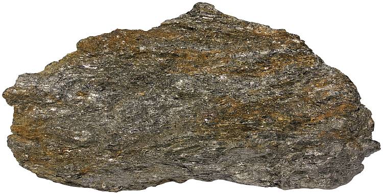
Schist is a strongly foliated medium-grade metamorphic rock. It is characterized by an abundance of platy or elongated minerals (micas, chlorite, talc, graphite, amphiboles) in a preferred orientation. Varieties of this rock type share similarities in appearance (schistosity) but may be highly variable in composition. Individual mineral grains are discernible by the naked eye. This property sets it apart from slate. Schist is one of the most widespread rock types in the continental crust.
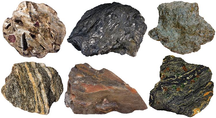
Varieties of schistose metamorphic rocks: 1. Mica schist with porphyroblasts of garnet, staurolite and kyanite. 2. Graphite schist. 3. Chlorite schist (greenschist). 4. Quartzofeldspathic (gneissic) schist. 5. Staurolite schist with a twinned staurolite porphyroblast. 6. Blueschist (glaucophane schist with garnet and omphacite).
Some schists contain no platy minerals like sheet silicates or graphite, but in this case these rocks have to display a linear fabric (elongated minerals in sub-parallel orientation). Amphibole-bearing rocks with a lineated fabric belong to this group.
Schistosity is a type of foliation, characterised by the preferred orientation of elongated or platy mineral grains (which are abundant in schistose rocks). Schistosity is a result of pressure in the crust which forces the grains to align perpendicular to the force applied. This force may be compressive (in mountain ranges) or simply caused by the weight of the overlying rocks. Schist can form only if the compressed rock contains lots of elongated or platy grains. Growth of mica crystals during the course of metamorphism makes the schistosity more evident.
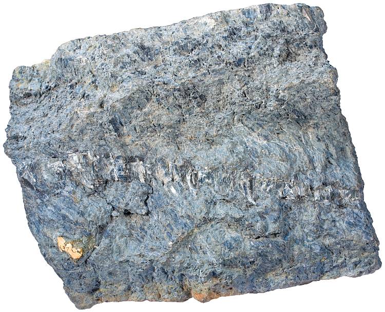
Mica schist is a very common variety. It is nicely glittering in sunshine because mica flakes act as small mirrors. Such rocks often contain garnet porphyroblasts (red crystals). Narvik, Norway. Width of sample 14 cm.
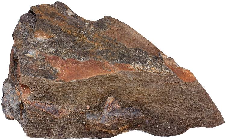
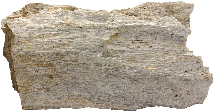
Metamorphic reactions between minerals upon increased burial will lead to the loss of schistosity because feldspar increases in abundance as micas become unstable. This process will lead to the formation of high-grade metamorphic rock gneiss (and gneissose fabric which can be described as a poorly developed schistosity). Sometimes schist is imagined to contain at least 50% of elongated minerals1, but in many cases the distinction between these rocks is just based on the qualitative assessment of a geologist describing the rocks in the field.
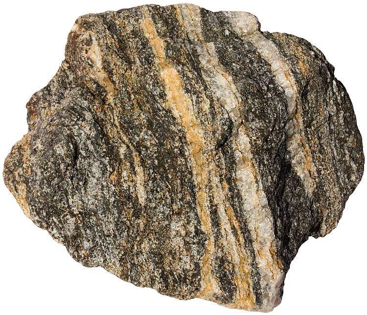
Some of the micas have already reacted to form feldspar. This sample seems to be approaching the imaginary boundary between schist and gneiss. Narvik, Norway. Width of sample 10 cm.
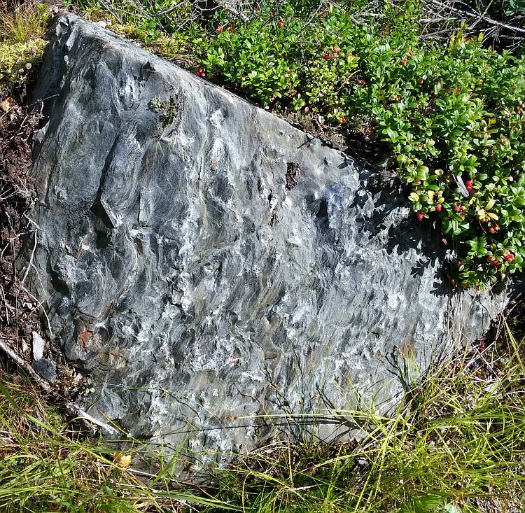
Schistose rocks are fissile, they have a tendency to split along sub-parallel planes (sometimes described as s-surfaces). This also sets it apart from gneissose rocks that have a lineated fabric but do not possess a fissile character. Fissile character gave this rock type its name — the Greek word skhistos means ‘split’, from the base of skhizein ‘cleave’. The rock name was introduced into the French language (schiste) in the late 18th century3.
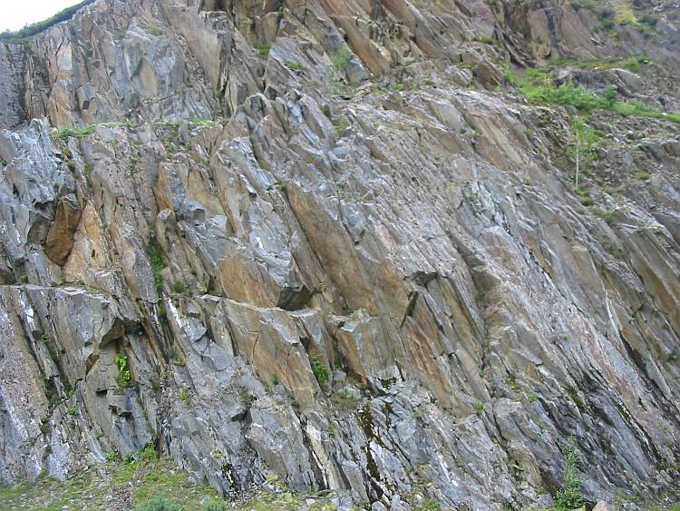
An outcrop of schist in Scotland. Note the fissile character which is evident in all scales.
The differentiation between schist and lower-grade metamorphic rocks slate and phyllite is also somewhat problematic. There is no easy way to quantitatively decide when one ends and another begins. The individual mineral grains in slate are not visible to the naked eye while they are clearly visible in schist. Phyllite is between them in metamorphic grade. Its constituent platy mineral grains are large enough to impart a silky sheen to the cleavage surfaces of the rock.
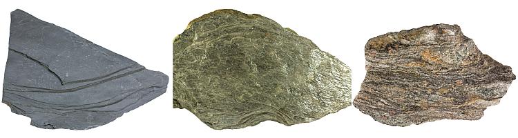
Increasing metamorphic grade and corresponding rocks slate, phyllite and gneissose schist from the left to the right. Slate is a fine-grained rock with well-developed slaty cleavage. Phyllite is coarser and has a silky sheen on the cleavage surfaces. Individual crystals in schist are clearly discernible. The rock may display compositional banding and it often contains porphyroblasts (garnets in this rock).
The family of schistose rocks is compositionally very diverse but most of them are derivatives of former mudstones metamorphosed to various aluminous schists (metapelites). Another major part of the family are rocks with a mafic igneous protolith. These include greenschists and blueschists. Green color is given to the former mostly by a chlorite group minerals. The latter contains bluish amphibole glaucophane. Sedimentary rocks that were rich in organic matter metamorphose to graphitic schists.
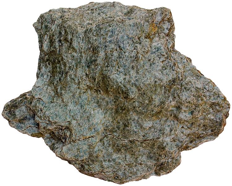
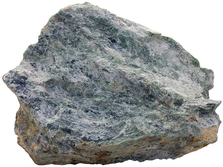
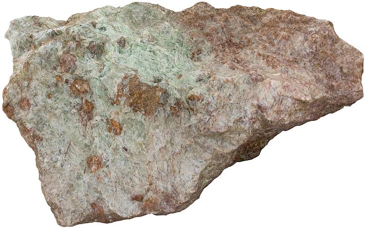
Chlorite schist (greenschist) is a metamorphosed mafic igneous rock. Width of sample from Norway is 14 cm.
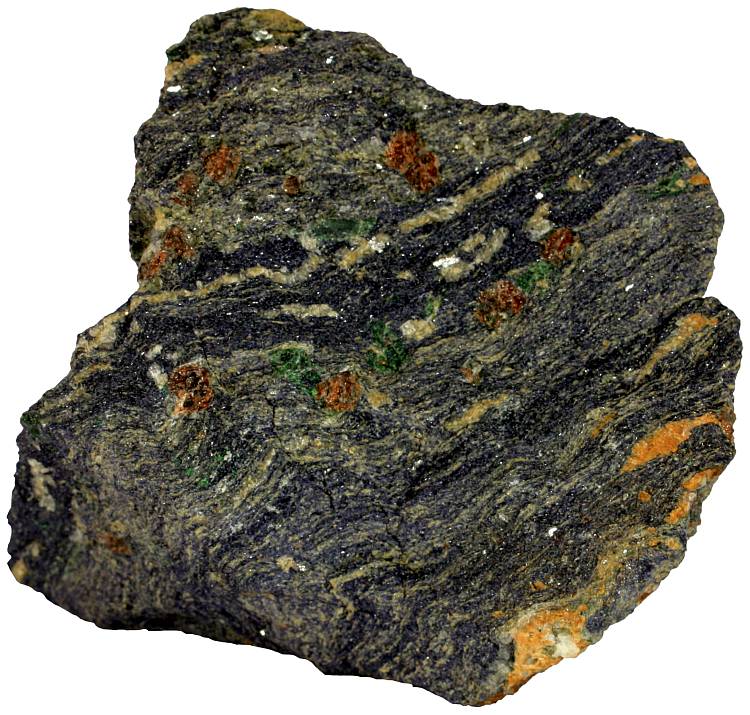
A glaucophane schist (blueschist). This sample formed at high pressure conditions. Green mineral is omphacite, red is garnet. These are the constituents of eclogite which is a closely related rock type. The Aosta Valley, Italy. Width of sample 6 cm.
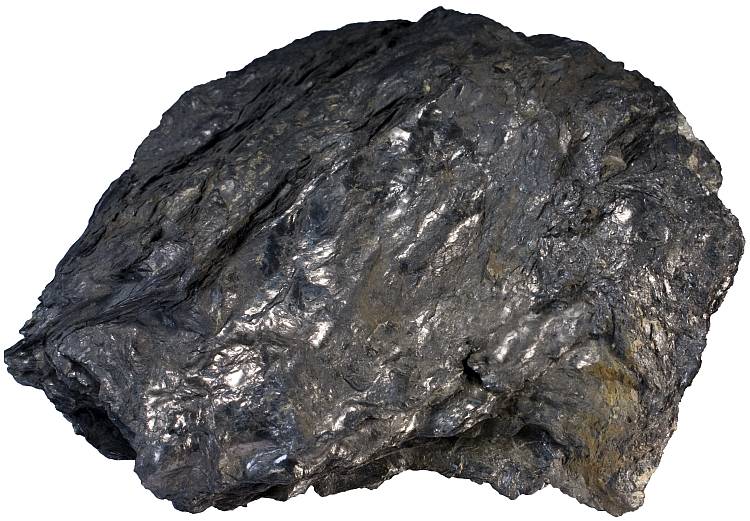
Graphite schist from the Urals, Russia. Graphite forms at the expense of organic matter in sedimentary protoliths. Width of sample 13 cm.
The name of a particular schistose rock depends on the dominant minerals present — muscovite-garnet-staurolite schist, for example. Several less known names have been given to a specific varieties: staurotile (contains staurolite porphyroblasts), prasinite (metamorphosed mafic rock with epidote, chlorite and hornblende in equal proportions), sismondinite (chloritoid is the dominant mineral phase).
Characteristically twinned staurolite porphyroblast in an Al-rich metapelite (staurolite schist or staurotile). Tohmajärvi, Finland. Width of sample 19 cm.
An outcrop of staurolite schist. Tohmajärvi, Finland.
Aluminous varieties often contain large crystals in a finer matrix. These crystals formed as the metamorphism progressed and they can convert to each-other as conditions change. Such large and often euhedral crystals are known as porphyroblasts. Common minerals that form porphyroblasts are garnet, staurolite, kyanite and andalusite. Porphyroblasts somewhat resemble phenocrysts in igneous rocks — both are larger crystals in a fine(r) matrix but the mineralogy is distinctly different. Quartz is a common phenocryst in igneous rocks, but it never occurs as a porphyroblast in metamorphic rocks. Feldspar, micas, olivine, pyroxenes and amphiboles are all common phenocrysts but uncommon as porphyroblasts2.
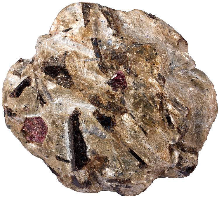
A sample of muscovite-garnet-staurolite schist that contains porphyroblasts of garnet (red, equant), kyanite (blue) and staurolite (dark, elongated). Width of sample 7 cm.
Foliation surfaces are commonly wavy which reflects the presence and growth of porphyroblasts. Microscopically, schists commonly show a crenulation fabric which indicates the presence of older foliation that may represent an earlier episode of deformation4.
Common minerals in schistose rocks indicate that these rocks formed at low- to intermediate grade conditions (subgreenschist, greenschist, blueschist, and amphibolite facies). This roughly corresponds to temperatures in the range of 300-600 °C and pressures from several to several tens of kilometers. This means that not only composition but the formation conditions too are highly variable.
Schist is rich in flaky and soft sheet silicate minerals which makes it structurally weaker than gneiss or granite. That is the reason why this rock type is used less frequently as a building stone. However, some varieties have an attractive appearance which makes them useful as a facing or decorative stone. Schist may be worth mining if it contains useful minerals in large concentration. Common minerals extracted from schistose metamorphic rocks are garnet, kyanite, talc and graphite.
A graphite schist sample from Trælen, Norway. This rock is mined because of its very high graphite content. Width of specimen 27 cm.
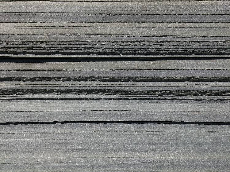
Quartz schist with perfectly parallel cleavage surfaces. This rock is quarried as a dimension stone. Alta, Norway. Width of view 50 cm.
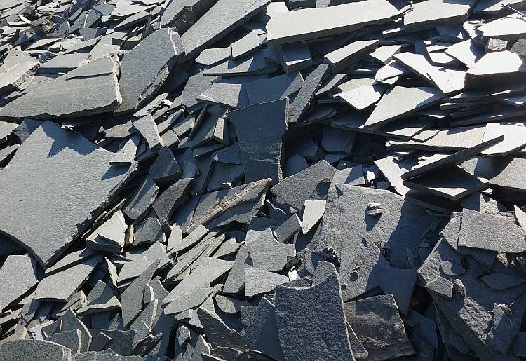
A heap of quartz schist slabs demonstrating platy habit which is caused by the abundance of platy minerals. Alta, Norway.
Talc schist is a source of talc. This rock type is also known as a soapstone because it is slippery when touched. Talc is a very soft mineral which makes it possible to cut this rock with a knife. Lipasvaara, Finland. Width of sample 14 cm.
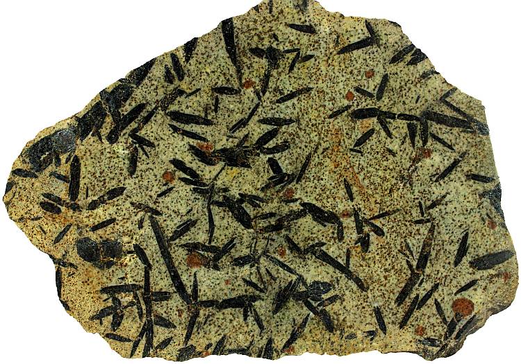
Riebeckite (amphibole group mineral) schist with a lineated fabric. Width of sample from Germany is 14 cm.
Andalusite (brown) porphyroblasts in a sericite schist sample. Kapteeninautio, Finland. Width of sample 12 cm.
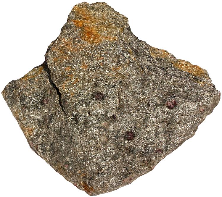
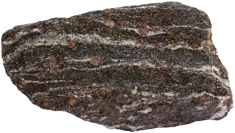
Garnet hornblende schist from Switzerland. Width of sample 19 cm.
Tonalite dike cutting through graphite-rich schistose rock. Width of the dike is approximately 15-20 cm. Trælen, Senja, Norway.
A schistose garnet amphibolite from Norway. Width of sample 16 cm.
An amphibole group mineral glaucophane gives blue color to blueschist.
A sericite schist from Kapteeninautio, Finland. Width of sample 15 cm.
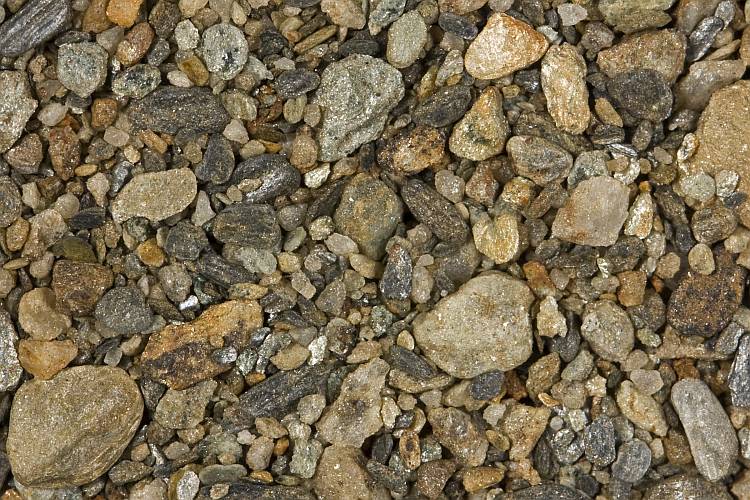
Small lithic fragments of mica schist in a river sand from Canada. Width of view 20 mm.
References
1. Jackson, J. A. (1997). Glossary of Geology, 4th Edition. American Geological Institute.
2. Best, Myron G. (2002). Igneous and Metamorphic Petrology, 2nd Edition. Wiley-Blackwell.
3. Schist. English Dictionary. Oxford University Press.
4. Van der Pluijm, B. A. (2007). Schist. In: McGraw Hill Encyclopedia of Science & Technology, 10th Edition. McGraw-Hill. Volume 16. 103.